Études de cas

Disaster Risk Reduction
Cross-sector
Coastal management
Buildings
Biodiversity
Agriculture
Forestry
Marine and fisheries
Water management
Urban
Transport
Tourism
Spatial planning
Sectors specific
Flooding
Extreme temperatures and heatwaves
Droughts
Changes in sea conditions
Wildfire
Water scarcity
Storms
Sea level rise
Non-impact specific
Heavy rains
Newest
Oldest
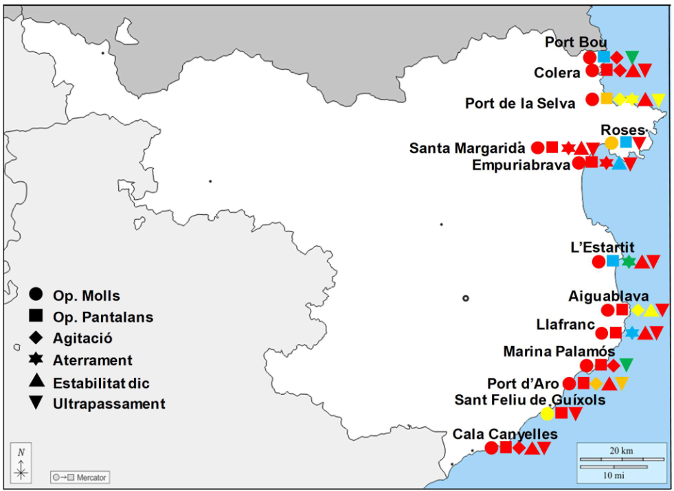
Map of risks in the North Port Zone, RCP8.5 scenario and horizon 2100, with types of risks, from very low risk (green) to very high risk (red). ©Pla d’adaptació al canvi climatic dels ports de Catalunya (2023), page 307.

Adapting ports and promenades in Catalonia, Spain

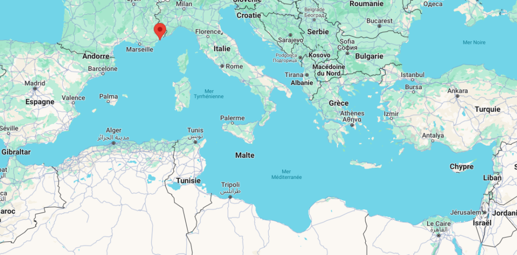
CASAdapt Project: adapting coastal socio-ecosystems to climate change, CASA Région SUD PACA, France

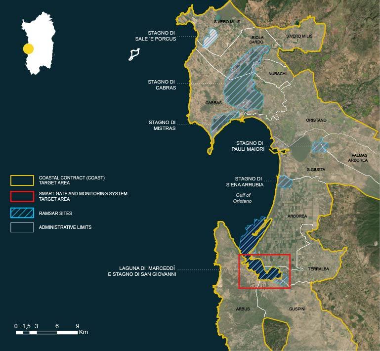
Coastal wetlands management of Maristanis, Sardinia, Italy

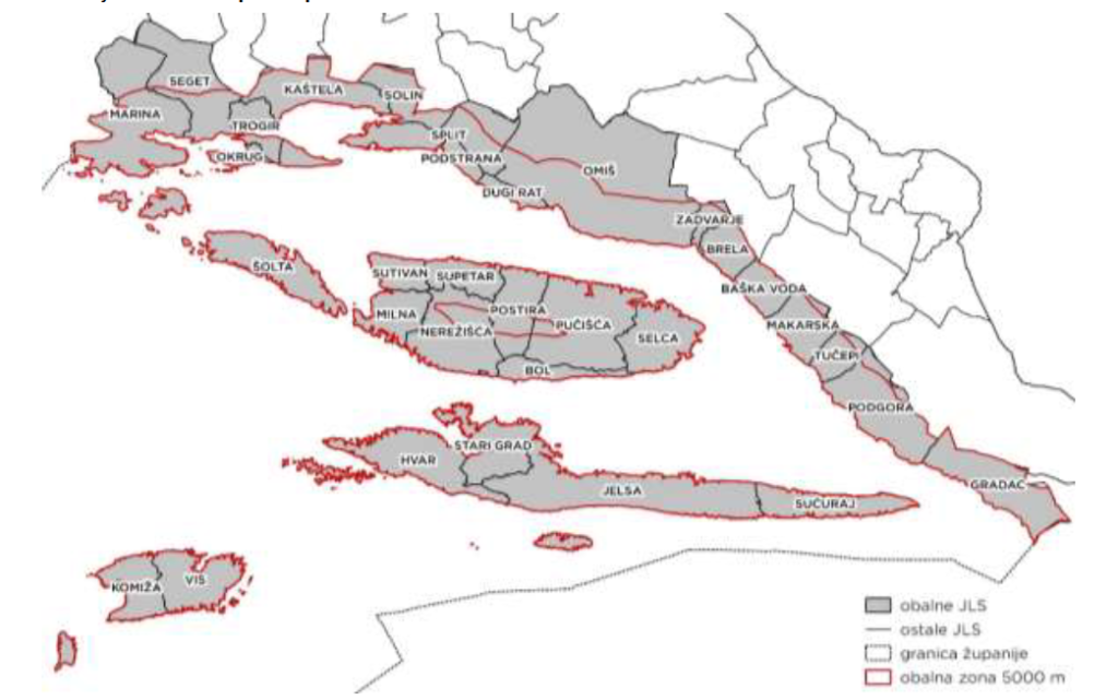
THE COASTAL AREA OF SDZ - in the sense defined by the ICZM Protocol and the Spatial Planning Act, includes the area of ​​32 local self-government units (11 cities and 21 municipalities) with a coastline, which occupy about 41% of the land surface of SDZ.

Coastal Plan of Split-Dalmatia County, Croatia

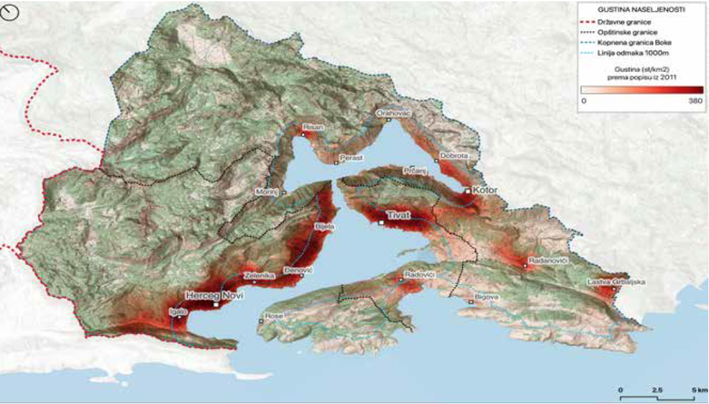
Boka-Kotorska Bay, population density

Coastal Management Plan for Boka-Kotorska Bay, Montenegro

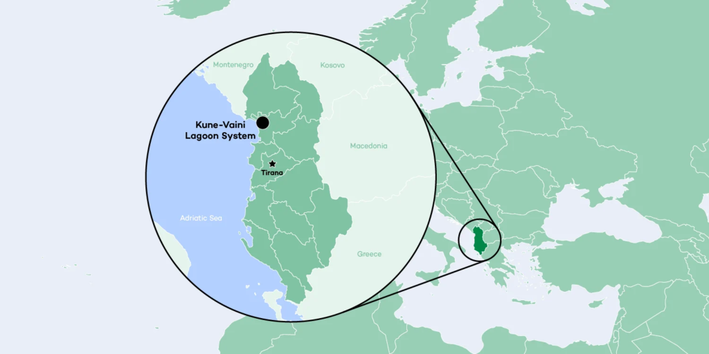
Kune-Vain Lagoon, Albania

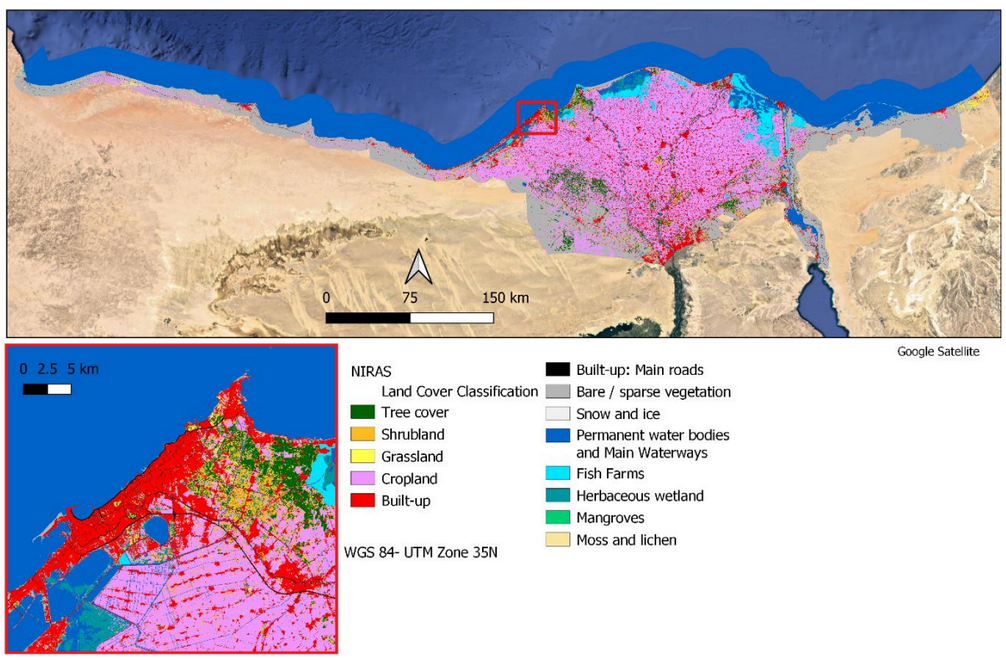
Enhancing Adaptation in North Coast and Nile Delta, Egypt

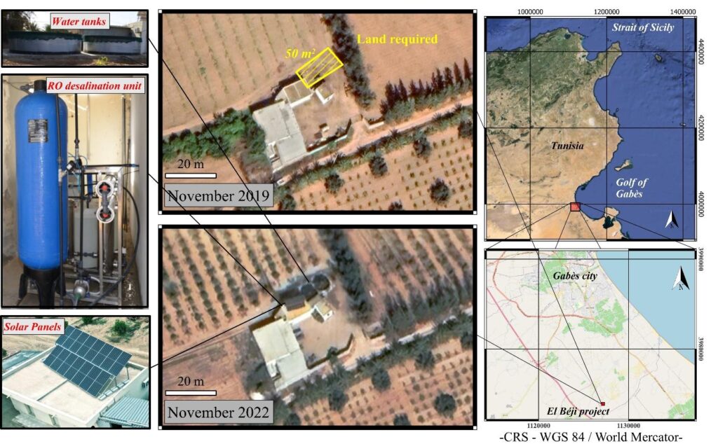
Renewable desalination for sustainable agriculture in Gabès, Tunisia

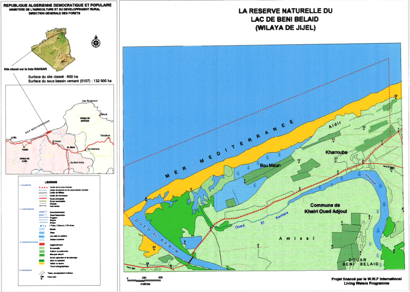
La reserve naturelle du lac de beni belaid

Dune belt rehabilitation, Béni-Belaid Nature Reserve (Jijel, Algeria)

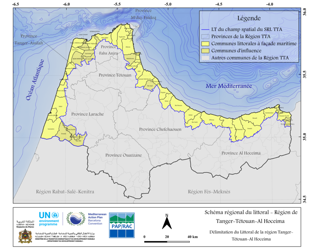
Map of the Region: Geographical location of the TTA region and its administrative subdivisions, with the chosen spatial zone of the coastal plan TTA (champ spatial du SRL TTA).

Coastal Plan Tangier-Tetouan-Al Hoceima (TTA) region, Morocco

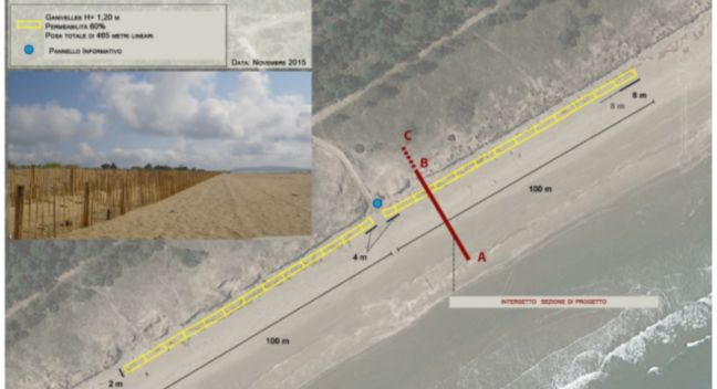
Dune belt restoration south of the Bevano river mouth, Italy

Green

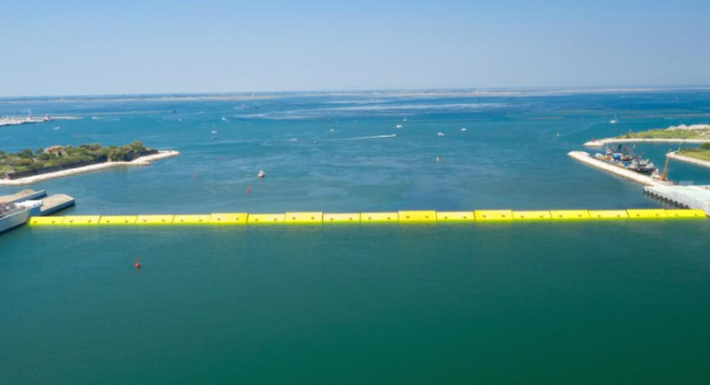
Integrated flood protection system of Venice and its lagoon

Grey